International borders are not a new thing to us. History shows the start of most of them; today we still witness the fight for more. Sometimes these borders can become known with peace and other times it's done with aggression and war. This is what also shows us which countries like each other and which ones don’t. Many countries have some humorous or adventurous ways they show their border lines whereas others blatantly show the two different sides. Take a look at which countries make the most of their borders, whether you agree with them or not, they won’t disappoint.
Austria and Slovenia
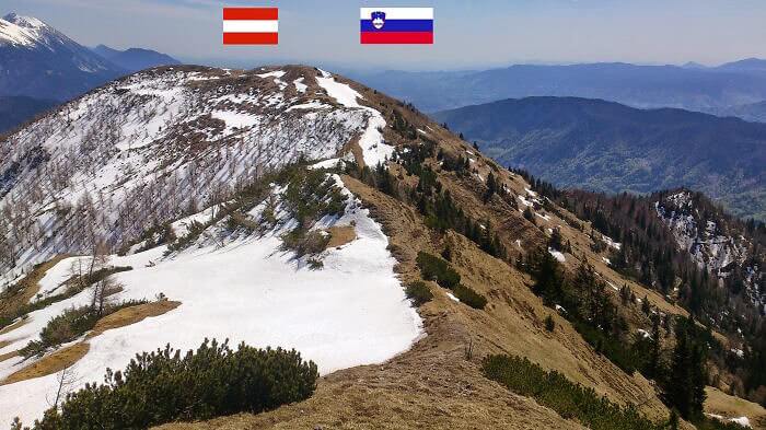
The Austrian and Slovenia border which lies mostly in the Alps shows quite a unique difference, not driven by a path, line, or post, but by nature's own weather. Austria is noticeably the colder side of the Alps with snowy mountain tops, something you would expect to see in Austria. But Slovenia’s side of the Alps has much less snow, which would mean they are on the sunnier side of the mountain.
So, if you’re ever traveling in Slovenia, just know when the temperatures drop and you see snow, you’ve most likely crossed into Austria and if you don’t like the cold, you’ll want to turn around.
Scotland and England
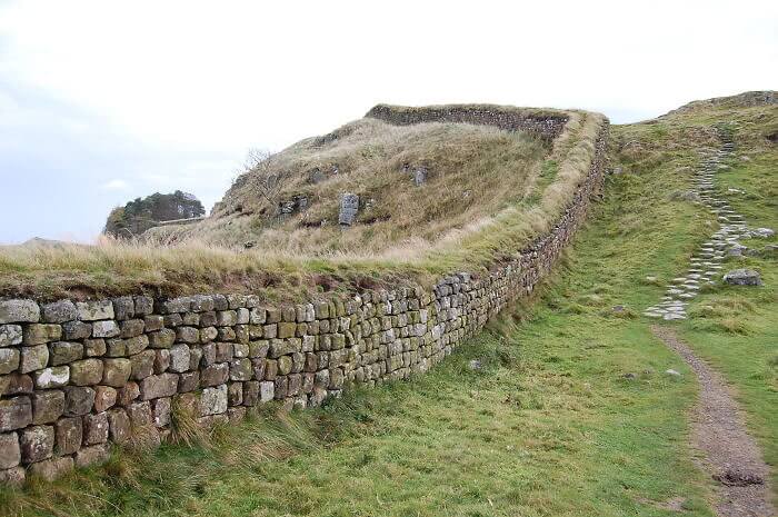
The Hadrian's Wall which lies between England and Scotland was built-in AD 122 and took 60years to build. The Romans built the wall because they didn’t like the Scotts. But funnily enough, the wall was built about 73 miles away from Scottland and it is said it was because the Romans did not want to get any closer to Scottland because they were afraid of the people, which is probably true.
Today the wall, which is not an acting border, is one of the biggest surviving archaeological landscape features where about 10% of it can still be seen for miles in England.
Germany and Poland
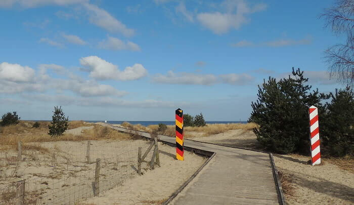
On the beach of Usedom, for about 286 miles, lies the German-Polish border. What's funny is that these two countries added their own poles to show who's side is who and for some reason, Poland’s one looks more like Santa’s North Pole pole or maybe even a barbers pole. Obviously, the poles match the country's flag colors, but the red and white of Poland are not as serious as Germany’s.
Having a border on a beach could be quite fun, you get to hop over if you want to sunbathe in Germany and just hop back to sunbathe in Poland.
Thailand, Myanmar And Laos
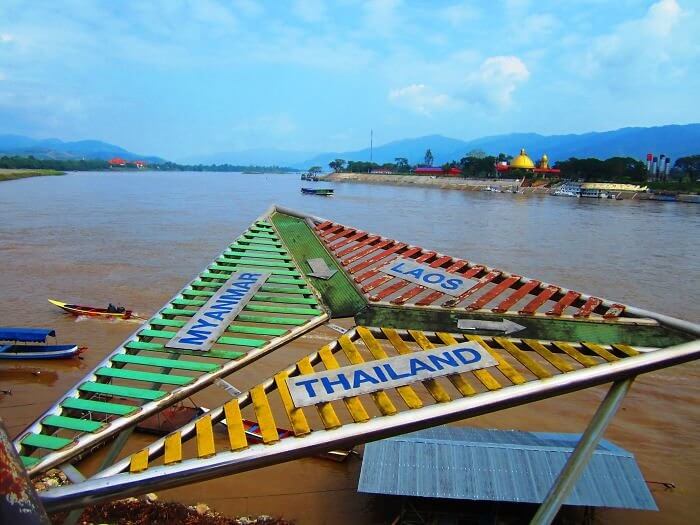
In South-East Asia you will find the not-so-golden, Golden Triangle. This is the meeting point for parts of Myanmar, Thailand, and Laos within the Ruak and Mekong rivers. Now, we’re sure you’re wondering why it is called the Golden Triangle when it looks more like a colorful one, but the name actually comes from the area that overlaps the mountains of the three countries which are part of the Golden Crescent.
The Golden Cresent is the area where illegal opium production happens. So while the triangle in the river seems cool, it’s best not to wander to the mountains where these points meet.
Argentina and Brazil
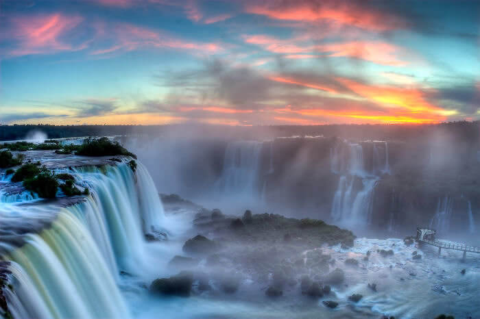
Argentina and Brazil have by far the best border any country could wish for. Their border is the Iguazu Falls, which means “an ocean plunging into an abyss” and that’s exactly what it looks like. Move over Niagra Falls, because the Iguazu Falls are twice as wide as it and way taller, with over 275 individual cascades. But that’s not all, on Argentina’s side there is a jungle to be explored with its own ecosystem.
This border even has its own microclimate filled with exotic plants and trees. If there is any border you ever want to explore, this should be the one on the top of the list.
North Korea and South Korea
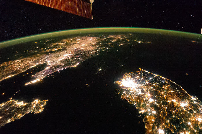
This satellite image taken during a blackout in North Korea shows the clear border between North and South Korea. The lit-up area on the bottom right shows South Korea and just above that the darkened space is North Korea. Luckily this is not what North Korea always looks like, however, when this image surfaced, North Korea was happy because they believed society is not about who is lit up more.
This shows a lighter version of the border compared to the dull ground border which may also be one of the most dangerous borders in the world. We’ll just look at it from the sky.
Germany, Poland And Czech Republic
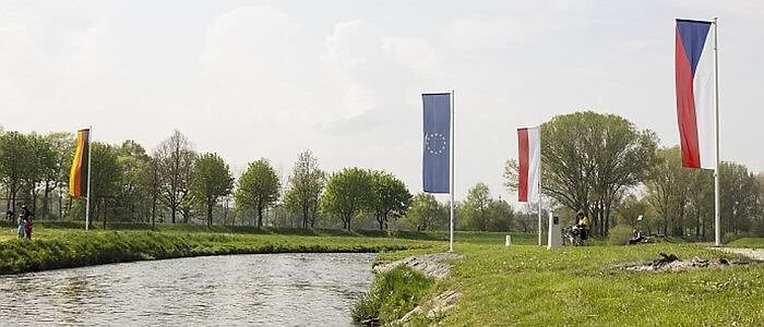
In Eastern Upper Lusatia there is a tripoint where the border of Germany, the Czech Republic, and Poland meet. At this point, the sides are marked with the country's flags as well as the European Flag which joins them all together as they all fall under the European Union. But some of the country's people believe these flags are incorrect because of how they are positioned, so we rather call them pennants.
Tripoint borders are not unique but they do open up an attraction for tourists to enjoy. Because who does not love saying that they were in 3 countries at once.
Egypt and Israel
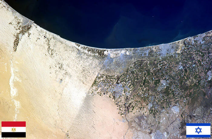
In this excellent satellite photo, you can see the clear divide between Egypt, Israel, and part of Gaza. The border looks like a straight line, which may actually be because of the barrier built by Israel, along the border. The fence runs out 152 miles and cost about $450 million to make, which would mean that the country was serious about keeping people out of their side of the border.
It is interesting how borders have such a clear divide. Usually, this is when you have hostile neighbors. When surrounded by friends you would not even know you’re crossing over to the other side.
Spain And Portugal
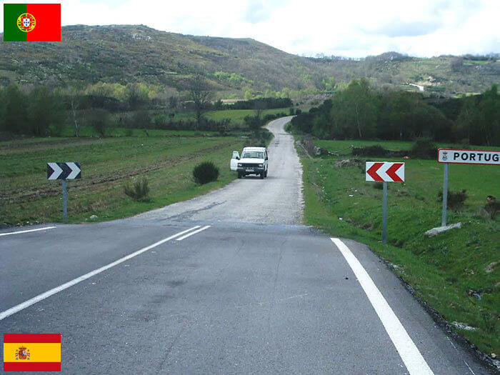
Outside of the main border between Portugal and Spain, there is a remote road somewhere which also shows the distinct separation between leaving or entering the two countries. You can clearly tell that Spain spends a lot more money on maintaining their roads than Portugal does and this also shows that Spain has no means at all to use their money on bettering even a small part of Portugal's roads.
We have to take this with a pinch of salt because remote roads should not really count as a tell-all for countries, but we do know now Spain can be a little spiteful.
Germany And Czech Republic
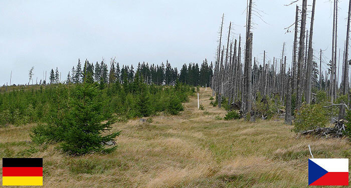
When your border point shows neglect versus intervention, then you must know that either one of the countries is doing something better than the other, or the other country is doing something to sabotage. Between Germany and Czech Republic’s border through the forests, you can distinctly tell which one is better at dealing with forestry than the other one. It is just another strange way to tell the difference between the two countries' borders.
And just like Spain previously, Germany to does not want to do anything to the forestry that is one inch over their border, making their side look much better to be in than the other.
USA and Canada
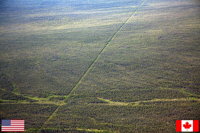
There are two land border sections that separate Canada and the USA. The mainland section is about 3986 miles and the other 1539 miles are between Canada and Alaska and this image shows just a portion of it. A well-maintained line makes it clear which side is which, although the land looks very much the same. Outside of this border, the Niagara falls also act as a border between the two countries.
It seems a bit unnecessary though that a maintained and paid-for line needs to show the distinct difference throughout a plantation area. But it’s not surprising coming from the USA.
Germany, The Netherlands And Belgium
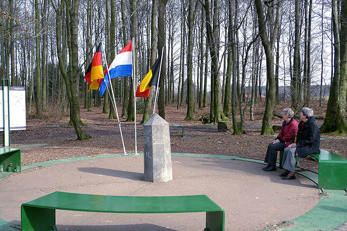
In a forest in Vaals in The Netherlands, you can find this point called the “Drielandpunt”, meaning three land points. Here is where the borders of Germany, The Netherlands, and Belgium meet and there is even a nice little seating place where you can choose which side you would like to sit on. We are sure if this ground can talk, there would be many interesting stories at this point.
This border point is quite a positive one because it shows how these three countries can get along enough to have a united seating area for different people to meet.
Sweden and Norway
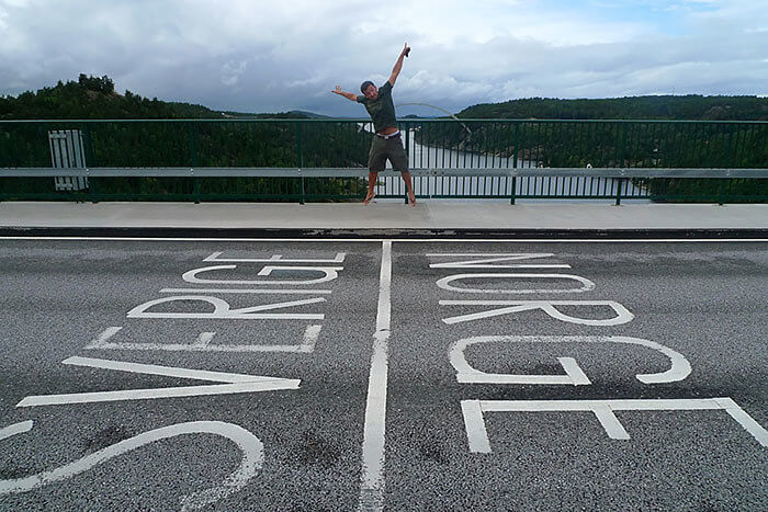
One of the less controlled borders you can find in the world lies between Sweden and Norway, it is literally just a line in the road showing the separation between the two, which makes it easy enough for anyone to bounce between the two countries. This border has no immigration controls but there are the usual customs checks that will still take place when entering either one of the countries.
Norway and Sweden have had a great standing relationship since 1905 which makes this minor border practical because, unlike many other countries, these two countries can get along very well.
Denmark and Sweden
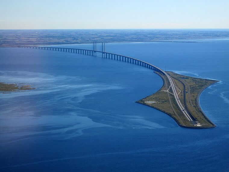
Another great border that works well is the one between Denmark and Sweden, and just like the relationship with Norway, Sweden and Denmark also get on very well. An almost 10-mile bridge called The Øresund Bridge connects Sweden and Denmark and if you thought that was cool, the Denmark side of the bridge even goes underwater creating a sunken tunnel. This was done as a safety measure to clear the air for flight traffic.
Besides the bridge, the same area also has a rail link that connects the two as well. So if you don’t feel safe driving underwater for a short while, you can just take a train.
USA and Mexico
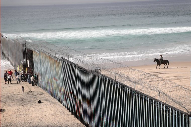
By now we should all know something about the border between Mexico and the US. If it isn’t the long-standing history of trying to stop immigration issues, it would be about the Trump Wall. This image shows a clear borderline between the two countries, which consists mainly of the original fence and only about 200 miles of it was Trump's “Impenetrable” Wall, which might we just add was breached over 3200 times.
This fence is located where Tijuana meets the Pacific ocean, but the border doesn’t really stop the Mexicans, so it seems it's mainly just for aesthetics.
Bolivia And Brazil
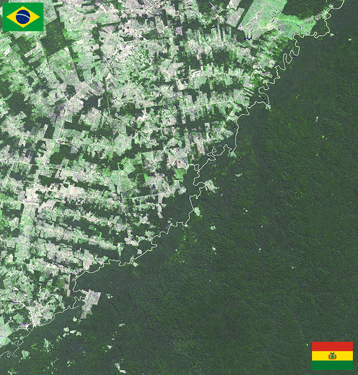
Here lies the border between Bolivia and Brasil and it is evident that Bolivia, a beautiful country, cares a lot more about forestation than Brasil does. This depiction is quite sad to look at because Brasil has become so overpopulated that there is very little care for the land and even the people. Whereas Bolivia has a lot to offer in terms of natural beauty and amazing sightseeing spots created by nature.
In the climate-changing world, we live in, it is nice to see that some countries are still trying to preserve their forests, just like Bolivia is. We could all learn from them.
Macau and Mainland China
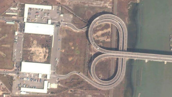
You will find this interesting border between Macau and Mainland China. In Macau, people drive on the left side of the road, and in China, they drive on the right side, so when people get to the barrier gate the roads loop over like this to send each side to the correct side. The full border between the two countries only runs 0.21 miles and along the coastline, the border runs 24 miles.
This looped road might make some people's dirty minds run, but its strange shape works for the two countries to manage the entry and exit without any border crossing issues.
Argentina, Brazil And Paraguay
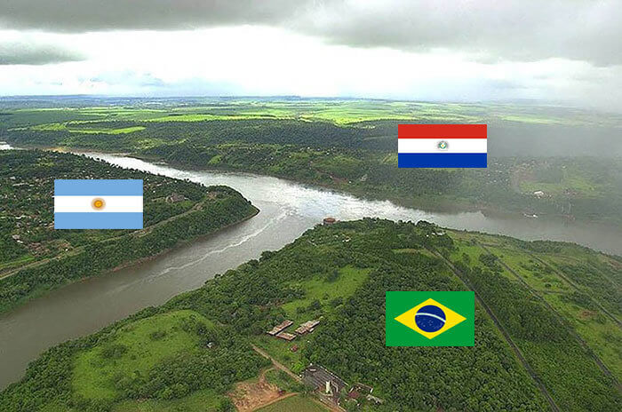
Triborders are not a new term to us, so this one is no surprise, but it does look amazing. The unofficially named T River separates Argentina, Brazil, and Paraguay creating The Triple Frontier. Officially the Iguazu and Parana rivers connect here as well. If you want to brave the water, you would only be a swim or short boat ride away from each of the surrounding countries. But we would not recommend that.
Similar to Sweden’s boarding relationships, Argentina, Brazil, and Paraguay have very good relations with one another. This is most likely why it would be easy enough just to row over to the other side.
USA and Mexico
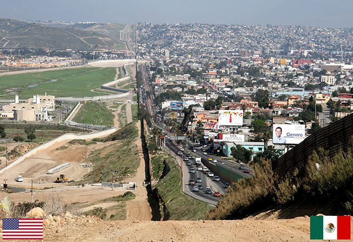
Another angle of the USA and Mexico border looks like this. Something a lot different to what we saw just a few pictures up. This part of the extremely long border is at the Border Patrol’s San Diego, and Tijuana Mexico. What is scary is that the Mexico side looks a whole lot like it should be the USA side, but this is truly how each of the sides looks.
The big building on the left is also a San Diego sewage plant that processes Mexican sewage as well to avoid it being pushed into the seas instead. So the US isn’t all bad.
Spain and Portugal
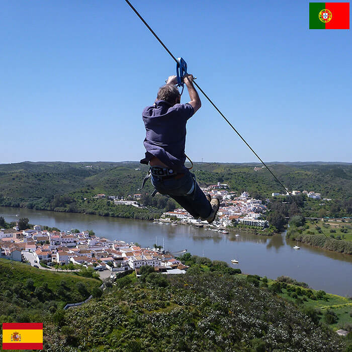
This is probably one of the cheapest forms of travel from one country to another, a simple zip line that connects Spain and Portugal. No luggage, travel meals, or travel service, but just a quick zip down. But, as it is a fun adventure to do, we would just hope you do not need to zipline with your passport on you for checks when you land on the other side.
This limit Zero experience also lets people cross the River Guadiana between the two countries as well as go into different time zones, so it becomes an extremely unique and unforgettable experience.
Poland And Ukraine
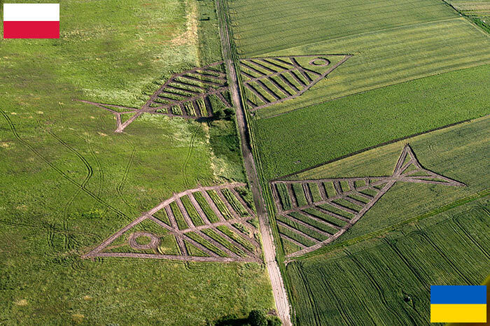
The border between Poland and Ukraine holds a very unique symbol. In the fields of Horodyszcze, Poland side, and Warez, on Ukraine's side, artist Jaroslaw Koziara grew 23 different plants in the shape of two fish that crossed over each border. His idea was to create something that symbolized the history of unity and trade between the two countries. But many argued against this work of art for the Land Art Festival.
Even though Ukraine is not part of the Schengen area yet, the artist argued that as artists they need to create ideas that spark border-defying projects, which is what his work did.
Australia And The World
This is the border between Australia and well, everywhere else. And if you do not get it, Australia does not border any other countries. This is quite funny though because Australia's Border Control show does a lot better than all the other countries' ones. And most people think they can get away with risky things when entering a country where they have nowhere but the surrounding ocean to run to.
This puts a greater meaning to the saying “we’re oceans apart” because that is all that is keeping Australia from any other nearby country, just miles, and miles of ocean.
Haiti And The Dominican Republic
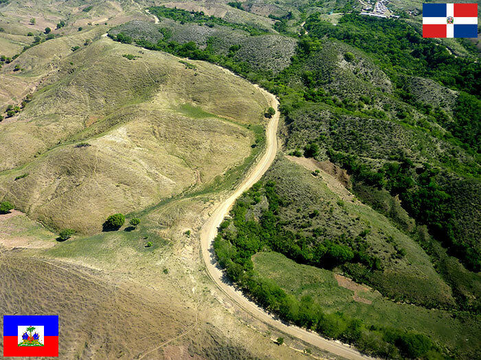
In the Caribbean Sea, you will find the island of Hispaniola which is made up of Haiti and the Dominican Republic. Their border however makes it extremely known that each of the countries has very different laws on protecting the environment. The Dominican Republic has lush forestation and well, it just seems like Haiti does not even care. This is the only time we can say that the grass is greener on the other side.
Images like this also make it known that not only are some countries' environmental laws vastly different but also their economies, governments, and their prioritized outlooks for their countries and the world.
Netherlands and Belgium
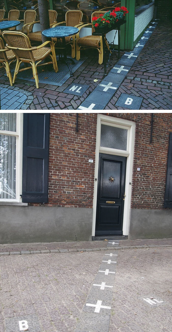
The border between The Netherlands and Belgium through the towns Baarle-Nassau, in The Netherlands and Baarle-Hertog in Belgium. They literally went an drew a line where the border is with no worry that it goes through a few houses and buildings as well. So the fun part is that you can send your partner to sleep in Belgium for the night if they get on your nerves, and by Belgium, we mean the kitchen.
This border coverage causes a few questions to locals, like which side some criminal cases should be handled and how to tell which country children would be born in if born in a house.
Norway and Sweden
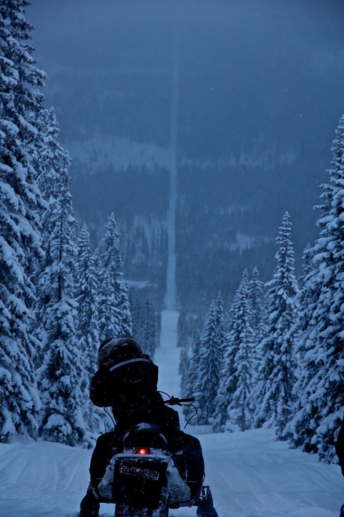
Between Norway and Sweden there is also a distinct border, but one more beautiful than that of a hostile wall. A 1010-mile border runs through the forest which is made into a deforest road. This is a great place for snowmobilers to ride on as there are no obstacles in the way. But once again, it is also easy enough to go off-road and enter another country, just like that.
This border is a spectacular sight to see and there are not many more like it. Like most other borders, this one is most definitely a tourist and local attraction and a bucket list must-see.
Slovakia, Austria And Hungary
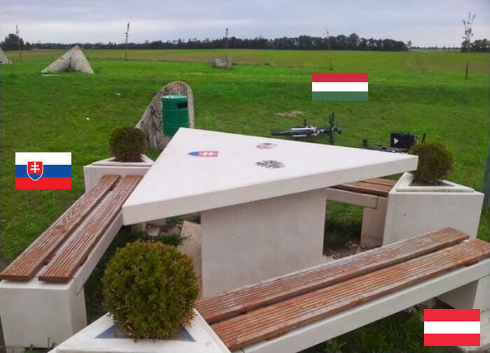
Another interesting landmark tripoint falls between Slovakia, Austria, and Hungary. Here there is a nicely built table with benches where you can sit on your side or even another country's side and come together. It gives a message of unity and togetherness which not a lot of boarding countries have. Each side of the triangular table is owned by each pertaining country, but that doesn’t mean you can’t sit on the other sides side.
The park where the table is situated was built after the fall of the Iron Curtain in 1991. The idea around the whole build was to create unity, which it’s done a good job of.
USA and Mexico
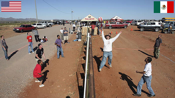
Now that we know the Mexico and USA border is really really long, we are not surprised that there is another shot of the border. This picture was taken in Naco, Arizona, and Naco, Mexico. Residents from each country are enjoying a game of Volleyball over the border fence. It is a phenomenal representation of how residents will not let a border stop them from being unified with the other side.
Pictures like this one show us how borders are just boundaries created usually by governments and that they can not stop the natural human connections that people have with others.
Tanzania and Kenya
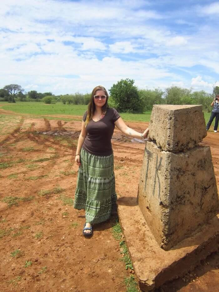
In Africa, there is a very bland, but still, touristic point marking the Kenyan and Tanzania border. This point is represented only by a stone marker, where if you stand on the one side you are in Kenya, and on the other side, you are in Tanzania. Although it is not the greatest landmark you will ever see, the travels building up to that point will be nothing but breathtaking.
The border stone will most likely not be something people jump to go and see, but if you’re traveling to enjoy the landscape and animals, it wouldn’t hurt to stop and snap a shot there.
France and Italy
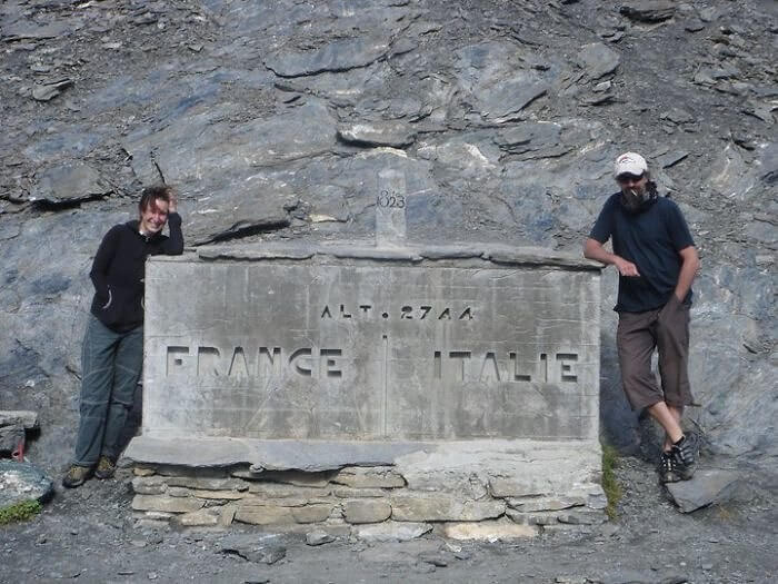
The border between France and Italy runs for 320 miles all the way from the Alps in the north to the Mediterranean coast in the south. Along the Alps, there is a monument pointing out the line between the two countries. This can be found in people who hike or more popularly, cycle along the paths. It has become a tourist attraction for many and just something to pass by by locals.
This marker has been around for years and although looking a bit old, is still standing strong to be a point of reference for those who travel along through there.
Switzerland and Liechtenstein
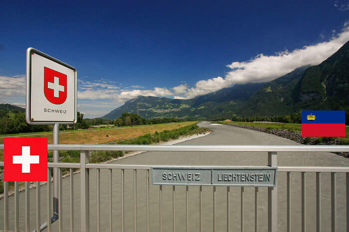
Liechtenstein and Switzerland share an open border that runs on the Rhine and Ratitkon part of the Alps between Flascherberg and Naafkopf. The land parts of the border allow people to also be in two countries at the same time, which we know tourists love. There are also various small signs that say “Swcheiz | Liechtenstein” that can be found around the border, like under bridges on fences, and on gates just like this one.
These two countries are also part of the few that get along as Switzerland has safeguarded Liechtenstein’s interests since 1919. But we all know regardless Switzerland likes to stay natural in most cases.
Cyprus and North Cyprus
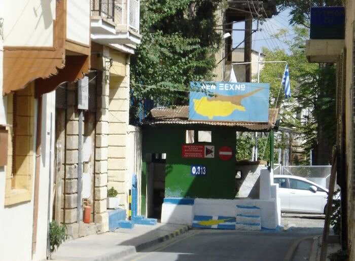
Because of ongoing disagreements between Greek Cypriots and Turkish Cypriots, Cyprus is now separated into Cyprus and Northern Cyprus. The Northern part is the Turkish Cypriot-controlled Turkish Republic of Cyprus and the rest of Cyprus is still Greek Cypriot-controlled. This means that people can travel from the South to the North or vice versa only if they have an EU passport, if not, they can not travel between the two.
There are also 7 border crossings between the two sides, so there is more than one way to cross over. The one pictured here is as easy as just walking through.
France and Spain
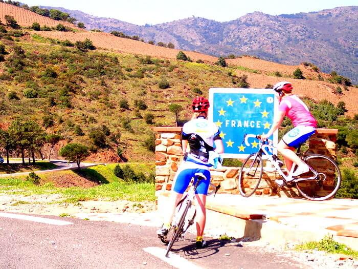
A great way to be able to cross borders is this one between France and Spain, where the border makes cycling through a recommendation. Cyclists can enjoy the scenic routes from Spain and then eventually enjoy the scenic routes of France all in one day. The 12 border points have made it easier for people to go on cycling day trips, tourism trips, or just to cycle through just for fun.
Cycling through the borders also makes for fewer cars to be coming through, so each country is doing its bit to try and make a difference with climate change and overall bodily health.
Ukraine and Slovakia
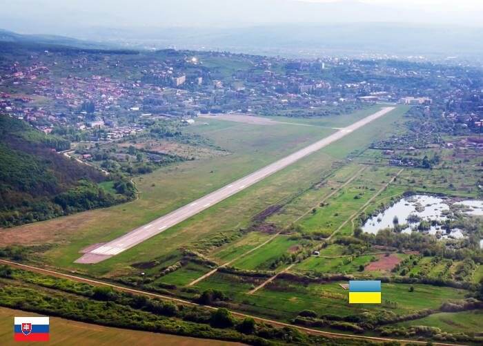
The border between Ukraine and Slovakia was established after WWII. The border runs only 60 miles. But this image of the Uzhorod Internation Aiport is quite important because the gap between the border of Slovakia and Ukraine here is only 436 feet. This has also made the airport the most sensitive airport in Ukraine at the moment because Ukraine literally touches the NATO country, making this place untouchable during the war.
With a strategically vital border so close, it is no surprise that Slovakia and Ukraine have such strong relationshipsare. In this hard time Slovakia has also offered refuge to many Ukrainians.
USA and Canada
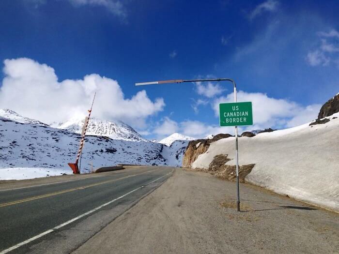
Traveling to Alaska on the road means you will need to go through Canada, and that also means you will have to make sure you are in line with the international travel and Canadian regulations to do so. However, Alaska only borders Canada in the East like this image from Yukon, Canada. If you’re traveling in the winter, you’ll be lucky enough to have a full trip surrounded by snow.
The distance between Alaska and the Welcome Sign on the Candian Border is 1551.78 miles, so if you’re up for the trip, make sure you’re ready for a long one.
Canada and USA
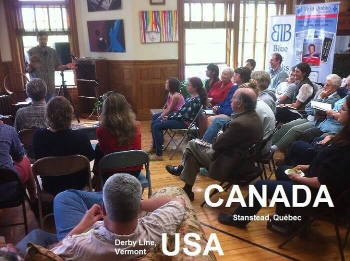
The Netherlands and Belgium were not the only countries that drew border lines right through buildings. In Vermont, USA, and Quebec in Canada, there is a library called The Haskell which has a black line running on its floor to mark the border of the two separate countries. You are able to have one foot in the US and the other foot in Canada and then still bounce between them.
This is one of the only libraries in the world that works for two countries at once. And luckily you can take books out from either side, not only from the side you’re from.
